

Table of contents
Introduction
Hey there, welcome back, today I am going to tell you about an interesting software that as of 6 months ago I had no clue existed.
I am going to be talking about Public Lab's very own Mapknitter Lite.
You might ask, "What is this Public Lab you're going on and on about?", well I'll tell you. Ever thought of how you could merge your love for the environment with your love for science and technology, or how you could get your Greta Thunberg-ing on through science and technology -haha, well Public Lab is the right place for that.
Public Lab is simply a place where one can go to find and share knowledge and equipment when investigating the environment -trust me I had no idea, a while back.
The Nitty-Gritty
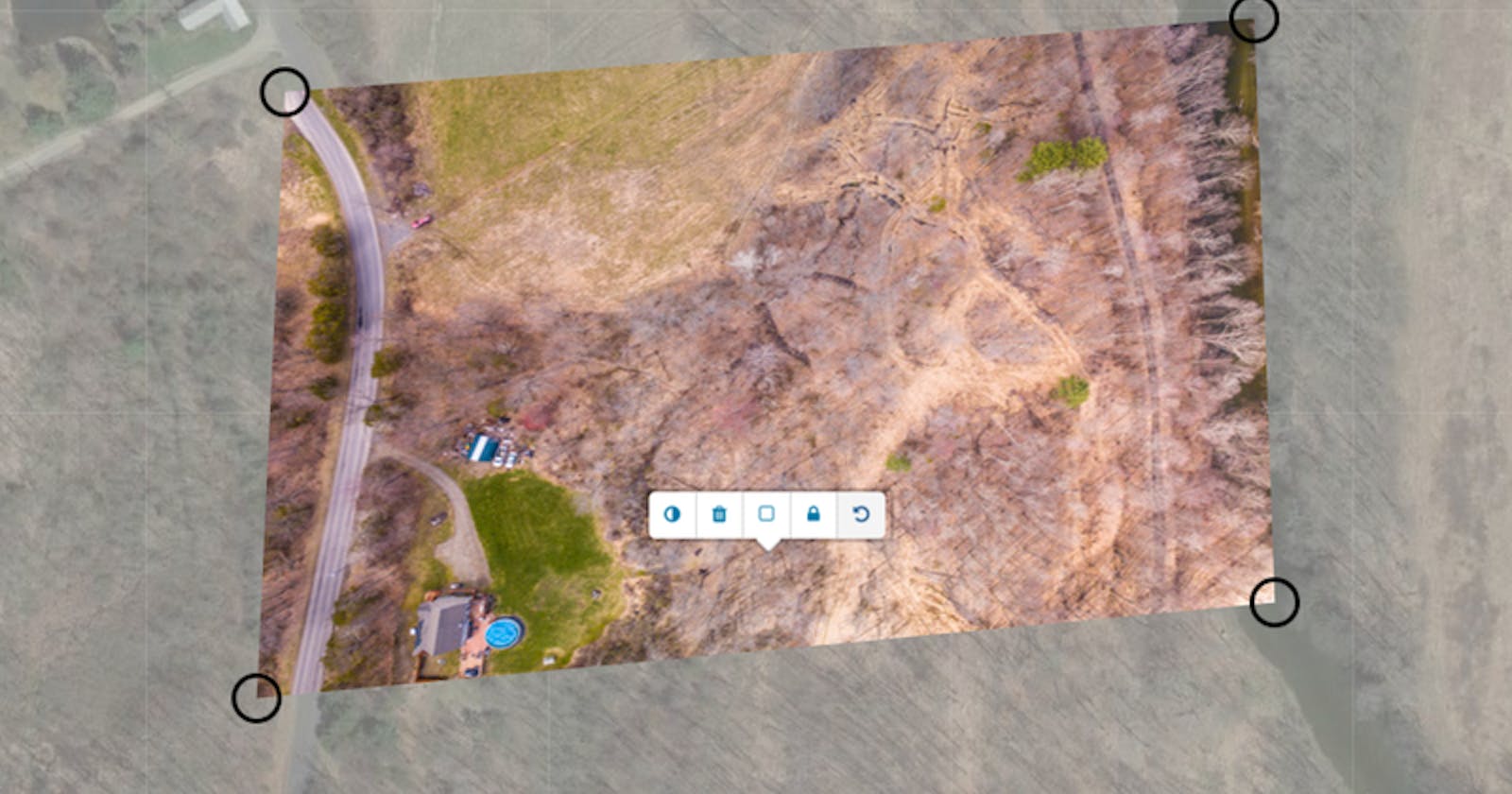
Now, the glorious Mapknitter Lite is one of the many tools Public Lab offers the environmentalists of the world. Let's use our imaginations for a second, imagine, you were to come across a lake such as the one in the image below:

Isn't that a lovely lake?...moving on, say you came across a lake such as this on a hike during a summer break and on your next visit this lovely lake was polluted, by say an oil spill, contaminating the entire lake. To make your report and/or your investigation you would need to get various data including but not limited to photographs among others and for proper context, you would want to pinpoint the location where this devastation devoured our beloved lake, well with Mapknitter Lite you can do more than just take handle-held or aerial photographs and maybe a pin drop location on your favorite map, with Mapknitter Lite you can take these photographs(aerial, of course) and place them on a live map, stitching(yes stitching, you read right) your photograph to the live map and share with your team...sounds absurd right? but its true and if you ask me, more effecient.
Consider the BP Oil Spill in the Gulf of Mexico in 2010, give that a good read for context.
Mapknitter Lite could be used for various environmental research not just reporting the sacrilige of our beloved lake. It could be used to show the effects of land degradation in an area, ever been to field a formally full of greenlife and then some years later, nada, nothing or the effects of erosion in a region, the uses are endless.
Conclusion
I wanted to keep this short as possible, so you don't get bored of me geeking over my current role in our fight for environmental justice. Public Lab is one of the best non-profits I know, if I do say so myself and it has been an honour so far, working on this tool for the betterment of our planet. Do check us out! Show some love :-p <3
And if you did enjoy my geekery -yes, its a word, if you did enjoy this; thank Outreachy for me/us i would not be here without them and drop a like or comment, i love interactions (from the safety of my screen -hehe) just kidding ;-)